LUGAR COMUN
ESTUDIO DE ARQUITECTURA

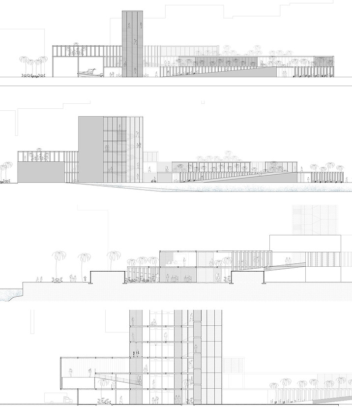
US COAST GUARD STATION, MIAMI RIVER
Professor: Fabiana Possamai Wills
FIU Department of Architecture
Fall 2019
Graduate Design 5 Studio
The US Coast Guard Auxiliary Station is a public building with a few private facilities. The project deliberately engages the order of the city and the wilds of water. It is critical that these programs link and connect these strong contexts. As such, the program should be conceived within their respective contexts: land-city, water-river or a hybrid of the two.
The New US Coast Guard Auxiliary Station is a focused piece of the US Coast Guard. As a local moment, it has the potential to become a truly public and social space at the heart of a community. Developing needs for community-based and educational services can reshape the role of reshaped and shifted the role of the Coast Guard.
The site for this program is also a precarious urban moment. Miami is a city defined by the water but it still needs to be asked: How does the Miami meet the water? Is it a public event? Is it a private event?


"Its no secret that most of South Florida is living in properes currently on borrowed me. Lile Havana, like many commu-nies, preside close to canals like the ‘Miami River’ and by extension, the coast; presenng many challenges with sea-level rise. Sea-walls, sandbars and connual effort put into prevenng the reality that sea-level rise within 50-100 years me will begin to consume large and larger porons of livable space and adaptaon now could preserve a threatened future"


Prediction of Sea Level rise in Miami Florida according to SeaLevelRise.org (table modified) and coast.noaa.gov. According to SeaLevelRise.org it is predicted that a range between 5.95 inches and 20 inches of water rise in 2050. With the Nooa simulation, it was possible to project 3ft of sea level raised projected to 2100 - worst case scenario. The areas covered by blue represented the expected flood- ed areas by that year.